Thursday, 22 April 2010


Waterside Natural History Society visit to Michelmersh
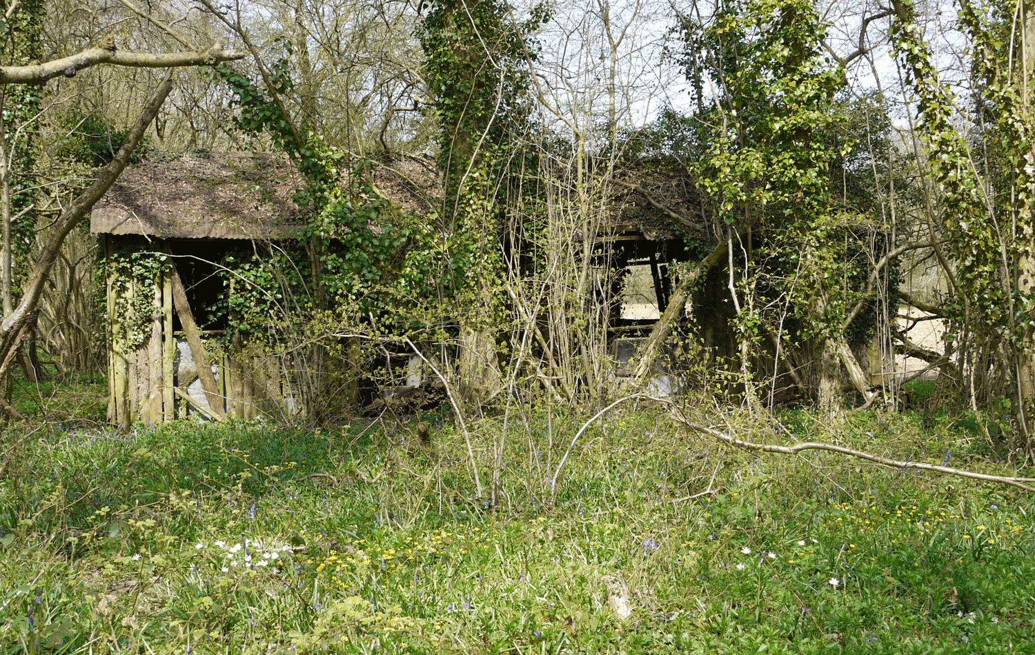
A combination of warm spring sunshine, beautiful countryside and an Icelandic volcano provided an excellent walk round Michelmersh in the middle of April. The volcano eruption meant that all plane flights were cancelled leaving the skies clear and the area noise free. We were able to listen to the birdsong instead. The Blackcaps, which have recently arrived from their migration, have a strong, melodic call with a variety of notes that is a delight to hear whilst walking through open woodland. We counted about a dozen during our walk, although we only saw two or three since they have a habit of hiding in the bushes. Chiffchaffs are another recent spring migrant with a distinctive call which happens to coincide with their name. Although their call is rather coarse and repetitive it is a welcome reminder of spring. Swallows and House martins appear to have reached their nesting areas but relatively few are seen on the wing at the moment. They are particularly fond of the barns and farm buildings which were scattered along our walk.
The walk, which starts and ends at the church in Michelmersh, followed a triangular route along tracks to Lower Eldon farm to meet Eldon road at Humbers wood then south along Eldon road before turning west back along the Monarchs way to the church. Roads in this area are not in the motorway class at the best of times and we were able to walk along Eldon road without meeting any traffic. Other tracks and lanes are quite substantial with tarmac in several areas. The distance is about five and a half miles.
Much of the earlier parts of the walk were through or alongside open woodland and one of the objects of the walk was to see swathes of bluebells. Unfortunately spring is about a month late this year and although some of the bluebells were in flower it will be the end of April before the blue swathes are evident. Other spring flowers were appearing however such as the Wood anemone, Celandine, Primrose, Barren strawberry and Violets. Both the early dog violet, with its pointed sepals and dark spur, and the sweet violet were present. Spurs of Solomans seal, just beginning to turn over at the top but not yet in flower, were present in numbers on the woodland floor together with Moschatel.
Between the woods the rolling chalk downland provided a familiar alternative. A good number of hares were seen during the course of our walk. It is always difficult to predict exactly where hares are going to be seen so coming across them unexpectedly and in such numbers was a delight. We also came across a group of Guinea fowl later in the walk but in an area of farmland such as this the wild and the managed animals are hard to distinguish.
During our walk back along Eldon road we called in to see the church of St. John the Baptist which is described as having the smallest parish in England. Its charm lies in its simplicity which consists of a single room with wooden chairs, a small organ and a small lectern for a pulpit. This contrasted nicely with a bright yellow primrose plant on the doorstep which appeared to be trying to get closer to heaven.
Eldon road appears to be an ancient pathway to King’s Somborne as it is sunk into the surrounding countryside and plants such as Butchers broom indicate mature woodland. Primroses and violets grew on the raised banks at a convenient waist height and cowslips were just coming into bloom. A variety of plants in the dead nettle family were coming into flower. The red dead nettle flowers all the year but the white dead nettle was starting to flower and the yellow archangel was just showing its characteristic yellow colour. The blue flowered ground ivy has also been in flower for a few weeks now.
Butterflies such as Brimstone, Peacock, Small tortoiseshell and Orange tip were seen as well as a Speckled Wood and a blue butterfly in a woodland glade which was probably a Holly blue. Holly blue are one of the first of the blues to be seen and can be recognised by their habit of flying at hedge height.
The flowers of Blackthorn and Plum cover the hedgerows in clouds at the moment but it is not a good sight if you are a hayfever sufferer. These are pollinated by bees and flying insects so don’t disperse a lot of pollen. Trees that pollinate by wind dispersal have no need of bright flowers so are not noticeable but a shake of the branches of any conifer tree can release clouds of pollen.
The walk although not overly long by rambling standards takes some time if you stop and look at everything so it was with relief that we saw the cock on top of the church tower as we came to the end of our walk.

Friday, 9 April 2010

Wilverley New Forest


Wootton Bridge via Wilverley (6.9miles)
This is a varied walk at any time of year but is particularly pleasant in summer. The walk can be started from any of three or four car parks and can be said to be a walk from one car park to another. I do not however recommend starting from the car park at Holmesley as it is a small secluded park near to the busy A35, an ideal place for thieves, and is often closed in winter to deter itinerant travellers. Wootton Bridge is a nice place to start for several different walks and is particularly good because you finish the walk unexpectedly after emerging from the wood.
So starting from Wootton Bridge we turned left on to the main road and crossing over the road we walked up to the junction at Wilverley. Just before the junction we veered to the right and crossed over the road to walk up towards Wilverley Lodge. The track follows the road and crosses over the access road to the lodge before continuing on towards the car park for Wilverley inclosure. We walked along the car park access road to enter the inclosure through the main gate. The main path, which is also a cycle route, continues ahead and when we came to an old inclosure sign with a wooden seat on the right we turned right along a minor path.
After fifty metres or so we turned left along an even smaller track which we followed until we came to a junction of tracks in a dip within an open space at which we took the path at about one o’clock. We followed this track for a short distance until we saw a track going to the right and leading us out of the woods. It is not important where you exit the wood so long as it is to the right hand side. Wilverley inclosure is a mixed deciduous and mixed coniferous wood which has been thinned over the years to encourage tree growth. Many of the coniferous trees are Douglas fir and growing quite large.
Once out of the woods we turned left and continued in a straight line following the edge of the wood as far as the main A35 road which we crossed over. The track then followed an old abandoned road over the open heathland. When we came to a bend and dip in the road we turned left between the second and third road markers through the hedge to the valley beyond. This is revealed as a hidden valley which is quite unusual in the New Forest and feels as if you have entered another world. When we did the walk in early April Lapwing were seen on the ground and one was in the air chasing off a crow. On emerging through the hedge we took a faint track round the right side of the marshy area which goes round the hill to the right. We then crossed over to the right of a low marshy area known as Holmans bottom before rising again to emerge at a minor road called Station Road. We saw a pair of bullfinch in the bushes of this low lying area.
At the road we turned left and walked along the side of the road for a short distance before crossing over the road to a car park. We maintained the direction of the car park access road over the brow of a hill to the left and followed the track downhill and over the heath. We could see a row of power cables in the distance and the track goes along the line of poles before veering off to the left towards a modern looking building on the road to Burley. On reaching this building, which is at the junction of the road and the dismantled railway, we turned left along the dismantled railway line back towards Holmesley.
At the end of the line we called in to the tearooms at Holmesley for our lunch. We then turned left out of the tearooms to walk along the road to the main A35 which we carefully crossed to start down a side road back to Wilverley. Instead of following this road we turned right opposite the forest car park through the hedge and over an old wooden stile. We followed the faint track over a bridge on the Avon Water and continued straight ahead across the water meadow to a five bar gate entering the Brownhill inclosure. The path then goes uphill to join the main track where we turned left to follow the broad path back to Wootton Bridge.

Tuesday, 23 March 2010


Cadland Manor
Lepe Country Park is a popular venue for visitors wishing to go for a stroll on a fine day or for beachcombing or just to eat lunch in the car whilst enjoying the scenery. The countryside does not end at the boundary of the park though but continues on to the surrounding private land; much of which is inaccessible to visitors. All is not lost however when Natural England combined with Environmental Stewardship come to the rescue.
Natural England is a public body that brings together English Nature, The Countryside Agency and Rural development service. Its aims are to conserve wildlife, maintain landscape quality, protect historic environment, protect natural resources and most important for us to promote public access. Environmental Stewardship is an agri-environment scheme run by the department for the environment and provides three schemes to assist land management. These are entry level stewardship, organic entry level stewardship and higher level stewardship. Cadland Manor subscribes to the higher level stewardship which means that it receives subsidies per hectare and for specific land management schemes. In return it agrees to abide by the aims of Natural England which for us means allowing some public access.
So it was that on a fine morning in the middle of March we were welcomed by our guide, and a Mediterranean Gull, to the estate of Cadland Manor and the coastline to the east of Lepe that visitors don’t normally see. Unfortunately the previous week had seen a great deal of rain and some of the paths were underwater to such an extent that it restricted our route through the estate. Spring is also late this year and the brown winter coat still covers much of the countryside. There are some signs of spring to show that it will win in the end such as the hazel catkins which have been producing pollen for a while now and you can spend some time looking for the small red flowers on the end of the buds.
Bluebell leaves cover much of the inland pathways so that it is difficult to avoid treading on them and the glossy green leaves of lesser celandine promise golden yellow flowers in the coming days. A few primroses are already in flower and the blue flowers of ground ivy are a welcome sight in the brown earth. The drier areas near the coast encourage Gorse to grow and they are spotted with yellow flowers at the moment.
We were lucky to see a slow worm trying to warm up on the pathway and an adder was spotted later in the day as it slunk away beneath the gorse. A group of forest ponies provided to keep down the vegetation were seen and a white mare had just given birth the previous night to a black foal with a white flash on its head. A single female Roe deer was disturbed as we moved noisily through the woods. Some of the trees growing in the poor soils and shingle struggle to grow properly and one oak tree appeared to be missing its trunk as its branches grew horizontally along the ground. Apparently this is a good spot to view purple hairstreak butterflies that normally live high up in the oak canopy.
Shingle forms much of the coastline in this area and provides good exercise for walkers. It also provides a good habitat for rare and unusual plants. Little robin which is named after ragged robin but is related to Herb Robert was producing leaves along much of the shore but was not yet in flower. Although on the surface shingle forms a clear coastline both the salty sea water and the fresh ground water can penetrate below ground so the separation is determined by the height of the water table. A low water table lets more seawater penetrate in to the streams and lagoons behind the shore making the water brackish and difficult for some plants to grow. The shingle has on the other hand formed a barrier across an area known as Jugglers Moor preventing sea water from flooding the low lying area and disrupting water flows on the landward side that previously drove the Stanswood Mill.
We had to return back along the shingle beach because of the flooded paths so a circular route was impossible. Nevertheless we had a worthwhile and interesting walk and are grateful for all the assistance provided by the estate of Cadland Manor.

Wednesday, 10 March 2010


Sparsholt Walk (7 miles)
We began our walk from the Crab Wood car park on the old roman road between Winchester and Salisbury. This car park was chosen because it was the first one we came to as we approached from Winchester and also because we did not know our route before we set off. In the event we walked further along the roman road before turning towards Sparsholt along the footpath between Crab Wood and West Wood. We did not have to travel on the road however as there is a track parallel to the road through the wood which would have been very muddy if it was not for the fact that the ground was frozen when we set out.
The track is called Burrow road on the OS map and follows a well wooded path even when it emerges from the wood and continues to a farm at the junction of the Sparsholt road. We could have cut the journey short by following the road to Sparsholt but we crossed over instead to Ham Green lane. The wide track has been designated a nature reserve called Sparsholt Common and gives extensive views over downland towards Sparsholt. At a junction of the paths we turned left back towards Sparsholt along a path that eventually becomes Dean Lane.
At the time of our visit in early March there were patches of snowdrops along the banks both in Dean Lane and in Sparsholt. Snowdrops, called ‘the fair maid of February’ in the past seem to flower consistently in February with scant regard for global warming. They also tend to favour the area near old dwellings rather than out in the countryside almost as if they liked human contact.
Although Dean Lane and subsequent roads through Sparsholt are tarmac they see very little traffic and are a pleasure to walk along. We continued our walk turning left at the end of Dean Lane and past the Plough Inn on the right. This pub looks at first sight to be little more than a small house but judging by the number of cars in the spacious car park it has a lot more room at the back.
The junction of roads after the Plough Inn is confusing at first but a street sign saying ‘Home Lane’ points us in the right direction and we walked straight ahead into this lane. Sparsholt village is located on a hill so the road leaving the village descends to a valley floor marked on the map as ‘no mans land’. The walk along the valley floor gives good views of the downland on either side and during March it is a good bet that hares will be seen gathering together for their march hare displays. We did see three hares at a distance but they never moved during our traverse of the valley. More unusually we also saw at least three buzzards walking on the ground and only occasionally flying short distances before settling on the ground once again.
When we approached an old barn on our right we turned left at a waymarked sign to cross between two unfenced fields and back towards west wood. West wood gradually encroaches on both sides of the path like a funnel before the path finally enters the wood. On entering the wood we continue ahead ignoring the left hand path and along a broad path back up to the roman road. The trees have been extensively thinned throughout the wood giving clear views to either side of the path.
When you think the walk is almost over upon emerging from the woods you are confronted by a fairly steep walk back up to the roman road. We had intended to turn right and visit the Farley Mount monument but the hill decided for us to return back along the road to our car park.

Wednesday, 24 February 2010


Blashford Lakes
We regularly visit Blashford Lakes and each time there is something new to see. It is particularly useful on a cold wet winter’s day, such as the day of our visit, because you can spend most of the time in the shelter of the bird hides and choose the time between showers to move to another hide.
The first hide that we visited was the woodland hide which is used as a location for feeding the small woodland birds or passerines. Although it is best to feed birds throughout the year now is a particularly important time because of the hard winter and lack of natural food supplies. The birds certainly seem to appreciate it as there were hundreds of small birds and one or two small animals visiting the feeding station at the time we were there.
There were at least two small bank voles dashing out when the birds were away and a rather fat grey squirrel that knew it was on to a good thing hanging round the feeders.
It might seem illogical going all that way when you can watch the birds feeding in your own garden but it is in a woodland setting. The variety of birds and the sheer numbers make it well worthwhile. For instance Siskins, Redpolls and Bramblings are not often seen in an urban garden. Redpolls are a small finch brownish in colour with black streaks. The head as its name suggests is red and it has a black bib; the males have a reddish chest during the breeding season. The Siskin is also a small finch but is greenish yellow with black streaks; the male has a black head. The subspecies of Redpoll have been divided into separate species recently so that the ones we saw are now called Lesser Redpoll. The larger and paler Mealy Redpoll or Common Redpoll may be found on the east coast of Britain in winter but the Arctic Redpoll as its name suggests remains further north. There was a single Long Tailed Tit which is rather unusual as they normally flock together. It was also noticed that there were no Goldfinch at the woodland feeders whereas in urban gardens they are quite common.
You could spend the whole of your visit watching the comings and goings at the woodland hide but eventually we moved, between showers, to another hide overlooking one of the lagoons with dead reeds in shallow water to the front of the hide. As it was near lunchtime we decided to eat our sandwiches in this hide.
Imagine you are a large Pike in a lagoon at Blashford Lakes; master of all you survey; ruler of all the little fishes. As it is a Sunday you are resting in the dead reeds when you feel a slight disturbance in the water so decide to move out of the reeds. Suddenly you feel a sharp pain just behind your left gills and instinctively spring into action trying to move as far away as possible but you are unable to move. You feel yourself slowly dragged just below the surface in such a way that no water flows through your gills and you cannot breathe. After a few minutes when you become weak you feel yourself flung upwards and your last feeling is one of disappearing down a black cavern.
We have finished our sandwiches and started on the apple. The Pike did not know what hit it but we did since we had been watching from our seat in the hide. We saw a Cormorant land on the water, splash through the reeds, and spear a Pike with its bill as it emerged into clear water. The Pike was at least as long as the body of the Cormorant which although normally swimming low in the water had its whole body submerged with the weight of the Pike, only its neck being above water. After a few minutes the Cormorant flung the Pike upwards, stretched its neck, and swallowed the Pike whole. The Cormorant must have struggled to walk on land never mind fly in the air.
After lunch we crossed over the road to Ibsley Water and looked over the water from two of the hides. Ibsley water is a large expanse of water and requires powerful optics to see to the far side. Pairs of Goldeneye however swim over the water diving for food and surfacing a long way from where they started, sometimes quite close to the hide. There seem to be more of these birds this year. Goosanders which were seen on a gravel promontory, appropriately enough from the Goosander hide, are also increasing in number.
We look forward to further visits, hopefully in better weather.

Thursday, 18 February 2010


New Forest Walks
Ashley Walk Car Park to Fritham (8miles)
This walk was done in the middle of February so there was not much in the way of wildlife but the scenery was very varied and the hills although moderate in height provide some exercise.
Setting out from the Ashley Walk car park the path descends quite steeply towards the bridge over the Ditchend brook. The path is well marked and the way ahead is clearly visible up the other side of the ‘Blackgutter’ valley. When the path levels out continue ahead ignoring side tracks and eventually the gorse bushes give way to more substantial trees before entering Pitts Wood inclosure. New Forest ponies and cattle tend to congregate on the heath before the inclosure and horse riders are a common sight on the weekend.
Follow the path through the wood crossing a bridge over a stream and upon emerging from the wood an old cast iron sign may be seen on the left of the path indicating when the area was enclosed. A number of paths merge at this point but the route continues left along the cycle track which is marked with a wooden cycle path sign. This path runs along the side of the Amberwood inclosure before it enters the inclosure itself and drops downhill between the trees. Much of this area is deciduous oak or beech trees which have been managed to provide pleasant open woodland.
Follow the main path through the woods, again ignoring paths to the right or left, and eventually the trees thin out and you get a glimpse of the fields around Eyeworth Lodge. There follows an uphill gradient under power lines towards Fritham and the car park. You can stop at the ‘Royal Oak’ pub for a meal and drink but they don’t like you to eat your sandwiches on the premises, not even in the beer garden, so we usually sit on the bench by the village green.
We continued our walk along the tarmac road towards Eyeworth pond which at this point is a single track road going downhill so you have to be aware of cars coming up behind. The pond is a man made feature but there are usually some interesting wildfowl on the pond. At the time we were there twelve Goosanders, both male and female, were swimming and diving quite close to the bank. We were also attracted to several Canada Geese who started calling and two more came in to land on the water flying no more than three metres above our heads.
The next part of the walk is largely over unmarked paths so a map and compass is useful but not essential. We continued along the road past Eyeworth pond until the road ends at the entrance to the last building of Eyeworth Lodge. The end of the road is marked by a gate barrier and a minor track goes to the right of the gate. We however walked to the left of the gate following a faint track along the fenced edge of Eyeworth Lodge. The object is to walk in a north westerly direction through the woods to meet up with the main path along the western edge of the woods so at a corner of the fence we follow the faint track which goes through a break in the inclosure boundary. The boundary at this point is a mound of earth about a metre high. Continuing in this direction we come to a gravel track with a deer fenced enclosure over the other side. Crossing the road we kept the fence to our left until it turned away and maintaining the same direction we came across the Latchmoor brook which we followed on our right. After a short distance we came to a small bridge with a small gravel path which we took to go over the bridge to our right.
The rest of the path through the woods is simply a matter of keeping straight along this path as it is crossed by other tracks, rides and firebreaks. Eventually the path goes uphill and emerges from the woods from where we continue ahead until we turn left onto the main gravel path from Telegraph hill to Ashley ridge.
This path can be followed until it meets the cycle path that we followed on the outward journey but if we take a right turn after some gorse bushes the view over towards Godshill is much more rewarding. The track is not all that distinct but is the only one to the right and rejoins the cycle path between Amberwood and Pitts Wood inclosures. From here we retrace our outward path back to the car park with the unfortunate bonus of a hill climb at the finish. At least we have the benefit of a good view over the route we have taken.

Thursday, 21 January 2010


Normandy Marshes

In the middle of the coldest week for some time it did not look very hopeful for our visit to Normandy Marshes at the weekend. However the snow and ice gradually cleared through the week giving way to rain on the Saturday and Sunday dawned as a bright sunny day without any wind; an ideal birdwatching day. Normandy Marshes are accessible through the marina at Lymington and after being housebound for much of the week a great number of people seemed to be intent on enjoying the good weather. Birdwatchers, dog walkers, cyclists and just plain walkers made the coastal paths like a town centre at Christmas.

The elevated paths along the sea defences not only provide good views over the sea and marshes they have the benefit of separating the people from the wildlife and the birds are quite content to ignore all the human activity. A Small Egret was seen at the start of the walk feeding in one of the shallow lagoons. The Egret stands in water up to a few inches below its body and shuffles its feet to disturb the mud thereby releasing small creatures which it stabs with its beak before swallowing. You begin to realise why the Egret has bright yellow feet and black legs since with black feet it would surely stab itself and by natural selection these birds would have all died out.
A whistling sound drew our attention to the Wigeon which are by far the most numerous duck at the moment with Teal not far behind. A group of Shellduck and Cormorants were interspersed with the Gulls, mainly black headed with the occasional Greater black backed gull. On the water Tufted duck and Little Grebes could be seen with the rarer Pintails. In the grassland several Curlew had gathered and round the edges of the water Redshank, Heron, Turnstone and Ringed Plover wandered about looking for food.

One of the advantages of walking in the countryside in the winter on a bright sunny day is the quality of the sunlight. In the summer the sun is directly overhead but in the winter the sun shines at a much smaller inclination and hence through a greater depth of atmosphere. This gives the light a more diffuse quality but the small angle can pick out greater detail on low ground features. A good example of this was the group of four Goldeneye that were on the surface of the second lagoon. Goldeneye are not often seen and are usually a small speck on the surface of the sea but on this occasion they were quite close on the lagoon and lit from behind us by the sun. We were able to see the black and white markings on the two male birds very clearly and when the sunlight caught their black heads they shone with a bottle green iridescence that was quite impressive.


The plumage of the male Goldeneye is at its best at this time of year because of the breeding season and we were particularly fortunate to see the mating display of the male birds. The Goldeneye extends its neck and head as high as it can by stretching and treading water before falling back to its normal position. This is followed by the bird throwing its head backwards towards its tail where it stays with its beak pointing to the sky for some time before repeating the whole procedure again.
One of the islands in the lagoon had a large flock of Dunlin with two Swans all resting during the warm daylight. A few Oystercatchers, Grey Plovers and Godwit were also seen. One or two Lapwing were on the ground but quite large flocks were seen passing over the reserve. A single Avocet was seen with its head tucked under its wing and standing on one pale blue leg.
After lunch we returned to the marina along Normandy lane on the landward side of the reserve. One field of short grassland had a mixed flock of Redwing and Fieldfares as well as a few Lapwing and Curlew. Redwing is something of a misnomer as the wing is not red. The red is on the flanks and is not easy to see when the bird is at rest as the wing covers most if not all of the red patch. The best means of identification is probably the bold eyebrow stripe which often looks more like a punk hairstyle. The birds are quite shy of man and when approached they fly as a flock to the nearest tree and then move after a few seconds when you have just found them in your binoculars.
Normandy Marshes is well worth a visit particularly on a bright winter’s day but don’t expect to be on your own.
The next outdoor meeting is to Blashford Lakes. Meet at the Oak Road car park Dibden Purlieu at 10am on 21st February 2010. Non members welcome at no charge.
The next indoor meeting is ‘A Hampshire Chronicle’ by G.Ponting at St Andrews Hall Dibden Purlieu. Talk starts at 7.30pm on 22nd February 2010. A small charge is made for non members.
Contact the secretary on 023 80893803 for membership details.